
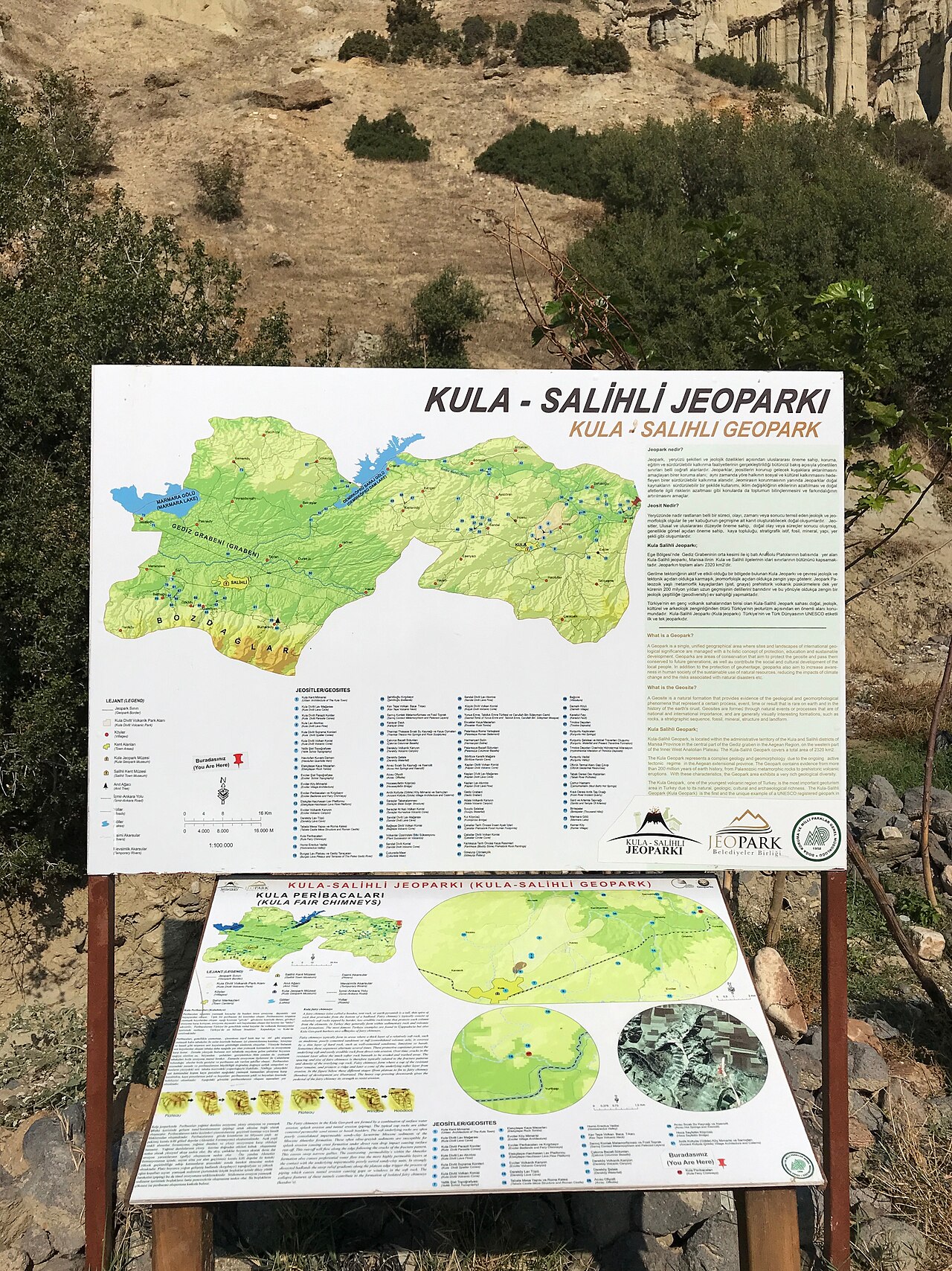
Kula Geopark covers about 300 square kilometers (116 square miles) across the Kula and Salihli districts of Manisa province and holds Turkey's only UNESCO Global Geopark title. Hoodoos, basalt columns and thousand-year-old fossil footprints can all be visited in a single day trip.
Why Is Kula Turkey's First UNESCO Geopark?
Volcanic eruptions in the area occurred in three phases during the Quaternary period, with the youngest eruptions ending around 15,000 years ago. The geopark's administrative center is in Kula town, while the individual geological stops are spread across the surrounding villages.
Where Are the Kuladokya Hoodoos?
The hoodoos known locally as Kuladokya stand beside the İzmir-Ankara highway near Yurtbaşı village. Basalt columns over 20 meters (65 feet) tall rise in the villages of Sarnıç and Çakırca. More than 200 fossilized footprints found near the Çakallar volcanic cone in 1954 date to the Mesolithic period, between 10,000 and 12,000 years old.
Why Are Kula's Stone Houses Protected?
1,400 of them are registered by the Izmir Regional Board for the Conservation of Cultural Heritage.
Ground floors were used as stables, storage rooms and kitchens, while upper floors projected toward the street. Some of the historic houses have been restored and now serve as accommodation or cafes, while most others can only be seen from the outside.
What Should You Know Before Visiting the Geopark?
The geopark's visitor center opened to tourism in June 2013, and a trail network of more than 12 kilometers (7.5 miles) connecting the main geological stops is marked with information panels. The cone slopes offer no shade, and the ground heats up at midday in summer; early morning or late afternoon visits are more comfortable. The scoria ground can be loose and slippery, so closed, grippy shoes are necessary. There is no shop inside the geopark, so bring your own water and sunscreen.
Who Is Kula Geopark Suitable For?
Kula suits visitors who enjoy walking, geology and photography. The cone and hoodoo trails are narrow, rocky and sometimes steep, making them difficult for wheelchair users or anyone walking with a cane. Families with small children should keep walks short, since strollers cannot be used on the trails. Public transport is limited, so a private transfer or a local tour is more practical without your own vehicle. Sunrise and sunset hours give the best light for photographing the cones' shadows.
Which Route Should You Combine Kula With?
Kula sits close to the ancient city of Sardis and Mount Spil National Park in Manisa, so all three fit into a single day. You can read about the latest excavation find at Sardis Ancient City in our guide. We covered Mount Spil's wild horses and the legend of Niobe in a separate guide. Travelers arriving from the airport can check our Manisa transfer page, then continue on to Kula with their own car or a local tour.
Frequently Asked Questions
How do you get to Kula Geopark?
Kula is a district of Manisa province, and the geopark area spreads around the town center. Driving your own car or a rental via Manisa is the most practical option.
Do you need a guide inside the geopark?
The main stops are marked with information panels, so the site can be visited without a guide. For lesser-known spots like the fossil footprints, a local guide is useful.
Can you go inside the Kula houses?
Some mansions have been restored into accommodation, cafes or cultural centers. Others are private property and can only be seen from the outside.
Is Kula Geopark suitable for visiting with children?
The area around the visitor center is flat and easy. The cone and hoodoo trails cross rocky paths, so short routes are better with small children.
What's the best spot for photos in the geopark?
The Kuladokya hoodoos near Yurtbaşı village and the basalt columns in Sarnıç village are among the geopark's most photographed spots.
What season is best for visiting?
Spring and autumn bring mild temperatures, dry ground and green vegetation, making these seasons better for walking than the hot summer months.